|
Home Search OKRoads: |
|
|
Home Search OKRoads: |
U.S. 69 Kansas
Southbound
What U.S. 71 is to western Missouri is what U.S. 69 is to eastern Kansas; the major north-south route in that part of the state. U.S. 69, unlike U.S. 71, is two-laned throughout most of Kansas, but construction to widen some parts of U.S. 69 to four lanes between Fort Scott and Louisburg is underway. U.S. 69 enters Kansas north of Picher, Oklahoma, and exits Kansas just south of Interstate 635 in Kansas City. It is a freeway from 359th Street near Louisburg to Interstate 35 in Merriam.
Pictures
Northbound (Oklahoma State Line to Louisburg)
Northbound (Louisburg to Missouri State Line)
| Southbound | |
 |
U.S. 69 South at
Interstate 70 East - St. Louis exit. (Photo taken 11/30/02) |
 |
U.S. 69 South assurance shield
just south of Interstate 35. (Photo taken 5/22/05) |
 |
U.S. 69 South approaching U.S. 56
- one-quarter mile. The mainline changes to U.S. 169 at the upcoming cloverleaf interchange. (Photo taken 5/22/05) |
 |
U.S. 69 South approaching U.S. 56
and U.S. 169. (Photo taken 5/22/05) |
 |
U.S. 69 South at U.S. 56 West and
U.S. 69 South. (Photo taken 5/22/05) |
|
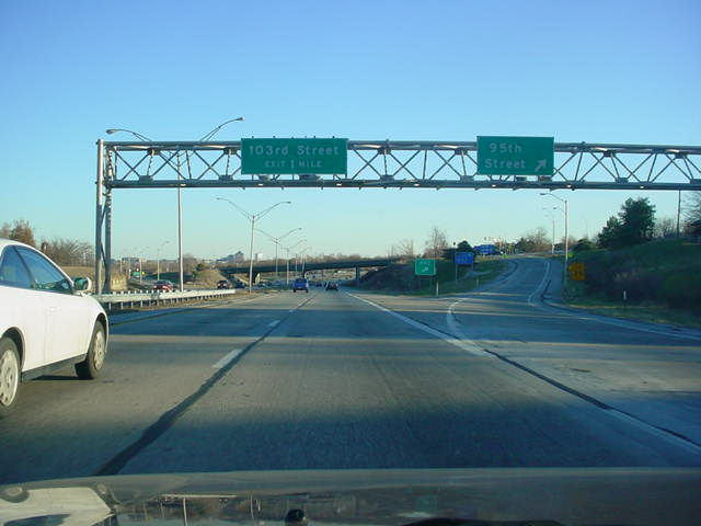
U.S. 69 South at
95th Street exit. (Top photo taken 11/30/02, bottom photo taken 6/30/03) |

|
U.S. 69 South at
103rd St. exit. (Top photo taken 11/30/02, bottom photo taken 6/30/03) |
|
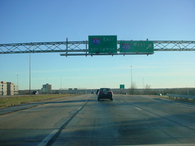
U.S. 69 South at
Interstate 435 West exit. (Top photo taken 11/30/02, bottom photo taken 6/30/03) |

|
U.S. 69 South at
Interstate 435 East. (Top photo taken 11/30/02, bottom photo taken 6/30/03) |
 |
U.S. 69 South approaching College
Boulevard West - 1/8 mile. (Photo taken 5/21/05) |

|
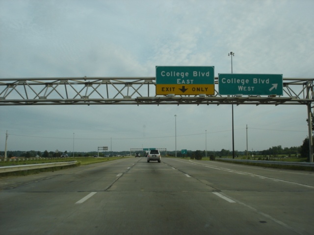
U.S. 69 South at
College Blvd. West exit. (Top photo taken 6/30/03, bottom photo taken 5/21/05) |

|
U.S. 69 South at
College Blvd. East exit. (Top photo taken 6/30/03, bottom photo taken 5/21/05) |
 |
Mileage sign on U.S. 69 South,
one-half mile north of 119th Street and three miles north of 135th Street. A U.S. 69 South assurance shield is attached to the sign bridge. (Photo taken 5/21/05) |

|
U.S. 69 South at
119th Street exit. (Top photo taken 6/30/03, bottom photo taken 5/21/05) |
 |
U.S. 69 South approaching 135th
Street - 1/2 mile. Traffic from the Blue Valley Parkway merges just behind this point. (Photo taken 5/21/05) |

|
U.S. 69 South at
135th Street. (Top photo taken 6/30/03, bottom photo taken 5/21/05) |
 |
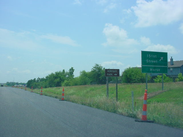
U.S. 69 South approaching 151st
Street - one mile. This is the final Overland Park exit before the freeway leaves suburbia. (Photo taken 5/21/05) |
 |
Use 151st Street east to visit the
Stanley or Kenneth areas of Overland Park. We don't know if there's anyone in those areas named Stanley or Kenneth, but it is a good possibility. (Photo taken 5/21/05) |
|
U.S. 69 South at 151st St. (Top
photo taken 6/30/03, bottom photo taken 5/21/05) |

|
U.S. 69 South at
167th Street. (Top photo taken 6/30/03, bottom photo taken 5/21/05) |

|
U.S. 69 South at
179th Street. (Top photo taken 6/30/03, bottom photo taken 5/21/05) |
 |
U.S. 69 South approaching 199th
Street - one mile. (Photo taken 5/21/05) |
 |
Use 199th Street east to either
Aubry or Stilwell. (Photo taken 5/21/05) |

|
U.S. 69 South at
199th Street. (Top photo taken 6/30/03, bottom photo taken 5/21/05) |
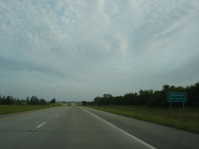 |
U.S. 69 South approaching 223rd
Street - 1/2 mile. (Photo taken 5/21/05) |
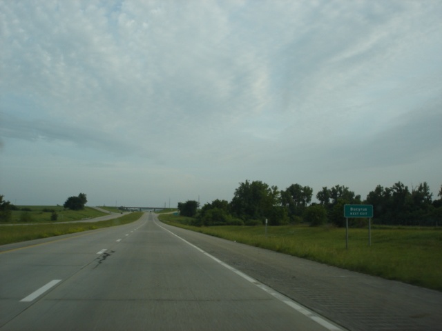 |
Take 223rd Street west two miles
to Quivira Road to visit the bustling town of Bucyrus. (Photo taken 5/21/05) |
 |
U.S. 69 South at 223rd Street. (Photo taken 5/21/05) |
 |
U.S. 69 South approaching 247th
Street - 1 mile. (Photo taken 5/21/05) |
 |
U.S. 69 South approaching 247th
Street - 1/2 mile. (Photo taken 5/21/05) |
 |
U.S. 69 South at 247th Street. (Photo taken 5/21/05) |
 |
U.S. 69 South approaching Kansas
68 - 1 mile. Kansas 68 connects Ottawa and Louisburg. (Photo taken 5/21/05) |
 |
A three mile drive on Kansas 68
West will lead motorists to the Louisburg Cider Mill. (Photo taken 5/21/05) |
 |
U.S. 69 South approaching Kansas
68 - 1/2 mile. (Photo taken 5/21/05) |
|
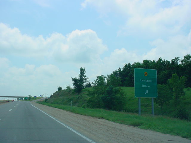
U.S. 69 South at
K-68 - Louisburg/Ottawa. (Top photo taken 6/30/03, bottom photo taken 5/21/05) |
 |
View at the end of the off-ramp at
Kansas 68. Missouri is five miles to the left, where the highway changes to Missouri 2. (Photo taken 5/21/05) |
Page created: August 15, 2005
Last updated:
August 17, 2005