 |
Home Search OKRoads: |
|
|
Home Search OKRoads: |
South Carolina 31
South Carolina 31 is a six-lane freeway to the west of Myrtle Beach. Its main purpose currently is to bypass U.S. 17 through Myrtle Beach. The speed limit is 60 mph for most of the highway's length, except for a section around the U.S. 501 interchange, where the freeway originally had its southern terminus before it was extended to South Carolina 544 in December 2004.
Pictures
| South Carolina 31 South | |
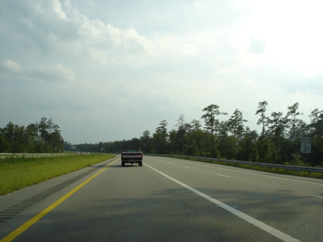 |
South Carolina 31 South assurance shield as the freeway begins. The two right lanes come from South Carolina 9 southbound. (Photo taken 7/6/05) |
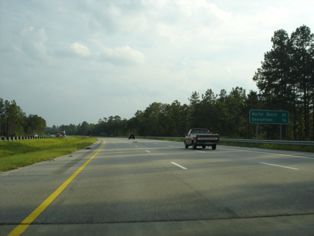 |
Mileage sign on South Carolina 31 South just south of South Carolina 9. Myrtle Beach is 22 miles away, while Georgetown is still a 56 mile drive ahead via South Carolina 31 south, South Carolina 544 East, and U.S. 17 South. (Photo taken 7/6/05) |
 |
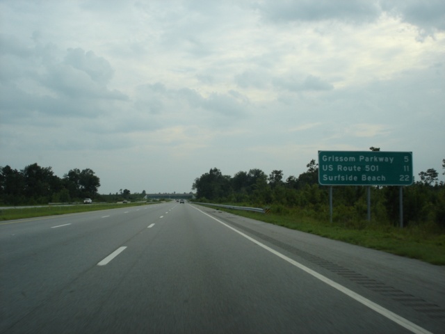
Another mileage sign just to the south advertises the next three exits; South Carolina 22 (6 miles), Grissom Parkway (12 miles), and U.S. 501 (18 miles). (Photo taken 7/6/05) |
 |
Use any of the next three exits (South Carolina 22, Grissom Parkway, and U.S. 501) to Myrtle Beach. The city has a population of just over 25,000 and is a popular tourist attraction, drawing in visitors from around the country. (Photo taken 7/6/05) |
 |
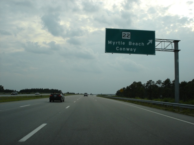
South Carolina 31 South approaching South Carolina 22 - 1 mile. South Carolina 22, also known as the Conway bypass but officially called the Veterans Highway, is an east-west freeway from U.S. 17 in Myrtle Beach to U.S. 501 north of Conway. The city of Conway is 17 miles from this interchange via South Carolina 22 West and South Carolina 90 South. (Photo taken 7/6/05) |
 |
South Carolina 31 South at South Carolina 22 - Myrtle Beach/Conway. A partial stack interchange is present here, with loop ramps connecting South Carolina 22 West to South Carolina 31 South and from South Carolina 22 East to South Carolina 31 North. (Photo taken 7/6/05) |
 |
A look at the stack interchange connecting two state highways. Both South Carolina 22 and South Carolina 31 may become interstates in the near future, once they are connected to the interstate system, hence the reasoning behind a stack interchange located at a rural-looking junction. (Photo taken 7/6/05) |
 |
Mileage sign on South Carolina 31 South immediately after the South Carolina 22 interchange. The next exit serves Grissom Parkway in five miles. (Photo taken 7/6/05) |
 |
Use Grissom Parkway south to U.S. 17 and to 38th-82nd Avenues in Myrtle Beach. East-west streets in Myrtle Beach are numbered, and increase as one heads in either direction from approximately U.S. 501. Streets northeast of U.S. 501 begin with 1st Avenue North, for example, and those southwest of U.S. 501 begin with 1st Avenue South. North Myrtle Beach uses a similar, but separate, system, which may cause confusion for those unfamiliar with the area. (Photo taken 7/6/05) |
 |
South Carolina 31 South approaching International Drive and Grissom Parkway - 3/4 mile. International Drive is a new arterial, one so new that the 2005 official state map does not show it. (Photo taken 7/6/05) |
 |
South Carolina 31 South at International Drive. (Photo taken 7/6/05) |
 |
South Carolina 31 South at Grissom Parkway. The parkway, named after Robert M. Grissom, is a new arterial providing a direct connection to the Myrtle Beach International Airport. (Photo taken 7/6/05) |
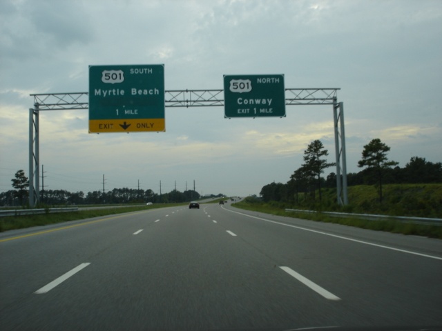 |
South Carolina 31 South approaching U.S. 501 - 1 mile. U.S. 501 begins at Business U.S. 17 in Myrtle Beach and travels northwest through Conway, Marion, and Dillon before entering North Carolina near the famous South of the Border truck stop and amusement complex, just off of Interstate 95. (Photo taken 7/6/05) |
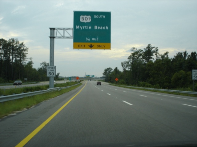 |
South Carolina 31 South approaching U.S. 501 South - 1/4 mile. The speed limit falls to 50 through the U.S. 501 interchange. Until December 2004, this was the southern terminus of South Carolina 31. (Photo taken 7/6/05) |
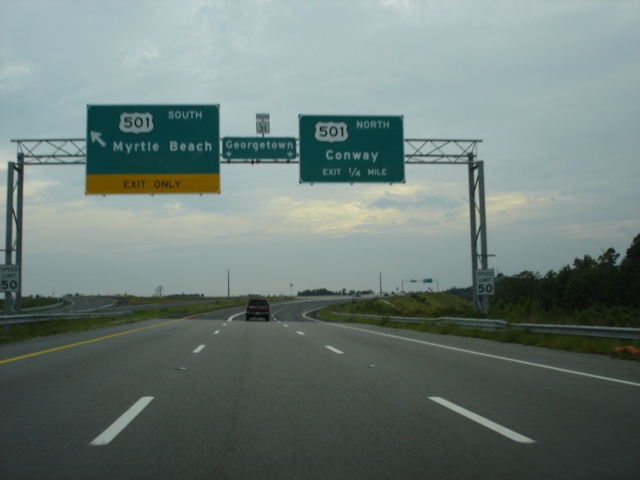 |
South Carolina 31 South at U.S. 501 South - Myrtle Beach. The extra green space on the sign once had "Georgetown" on it before the southward extension of South Carolina 31. A very small pull-through panel with a South Carolina 31 shield assembly attached to the top of it is present here and at the U.S. 501 North exit ahead. (Photo taken 7/6/05) |
 |
South Carolina 31 South at U.S. 501 North - Conway. The city has a population of 13,293 and is the seat of Horry County. (Photo taken 7/6/05) |
 |
Mileage sign on South Carolina 31 South after the U.S. 501 interchange. South Carolina 544 is four miles ahead, while there are still 36 miles to go until reaching Georgetown. (Photo taken 7/6/05) |
 |
South Carolina 31 South approaching South Carolina 544 - 1 mile. All traffic must exit at this trumpet interchange. (Photo taken 7/6/05) |
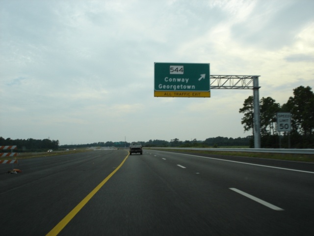 |
South Carolina 31 South at South Carolina 544 - Conway/Georgetown, as traffic is shunted to the right onto what will eventually be the collector/distributor lane. (Photo taken 7/6/05) |
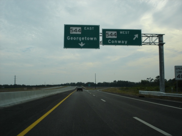 |
South Carolina 31 South at South Carolina 544 West - Conway. The city is 10 miles to the north. (Photo taken 7/6/05) |
 |
A look at the ramp that carries South Carolina 31 South to South Carolina 544 East. There is no end sign present here. (Photo taken 7/6/05) |
Page created: November 23, 2005
Last updated:
November 26, 2005