 |
Home Search OKRoads: |
|
|
Home Search OKRoads: |
Robert Moses State Parkway
The Robert Moses State Parkway travels along the shores of the Niagara River from Interstate 190 west to downtown, where there is a short break in the route. After leaving downtown, the parkway begins again and travels north through Lewiston to its northern terminus at New York 18 near Youngstown.
Pictures
| Robert Moses State Parkway South | |
 |
The Robert Moses State Parkway passes by the Niagara Power Project of the New York Power Authority just south of Interstate 190. (Photo taken 7/10/05) |
 |
View from the Robert Moses State Parkway just past the Niagara Power Project. New York 104 is just to the left. (Photo taken 7/10/05) |
 |
At top left, we see New York 104 West at New York 61 South. The state highway is four miles long and connects New York 384 to New York 104. (Photo taken 7/10/05) |
 |
Robert Moses State Parkway South at the Devil's Hole State Park exit. (Photo taken 7/10/05) |
 |
The BGS for the Devil's Hole exit was still on the original southbound lanes of the parkway, as seen here. The original southbound lanes have been converted into a biking and walking trail. (Photo taken 7/10/05) |
 |
A look at the Niagara River to the north of the Devil's Hole State Park. (Photo taken 7/10/05) |
 |
A look at the Canadian side of Niagara Falls and the Niagara River. (Photo taken 7/10/05) |
 |
The webmaster of OKRoads with the view in the above picture behind him. (Photo taken 7/10/05) |
 |
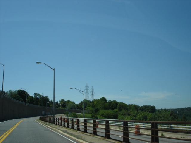
View of the Robert Moses State Parkway about three miles north of downtown Niagara Falls. (Photo taken 7/10/05) |
 |
Robert Moses State Parkway South approaching the Whirlpool State Park turnoff - 1/2 mile. (Photo taken 7/10/05) |
 |
Robert Moses State Parkway South approaching the Whirlpool State Park turnoff - 1/4 mile. (Photo taken 7/10/05) |
 |
Robert Moses State Parkway South at the Whirlpool State Park turnoff. (Photo taken 7/10/05) |
 |
Robert Moses State Parkway South approaching Whirlpool Street - 1/4 mile. The arterial provides a bridge to Canada, the Whirlpool Bridge. To use the Whirlpool Bridge, one must be a member of NEXUS, a joint customs and immigration program between the United States and Canada. (Photo taken 7/10/05) |
 |
Robert Moses State Parkway South approaching Findlay Drive and Whirlpool Street. (Photo taken 7/10/05) |
 |
Robert Moses State Parkway South at Findlay Drive and Whirlpool Street. (Photo taken 7/10/05) |
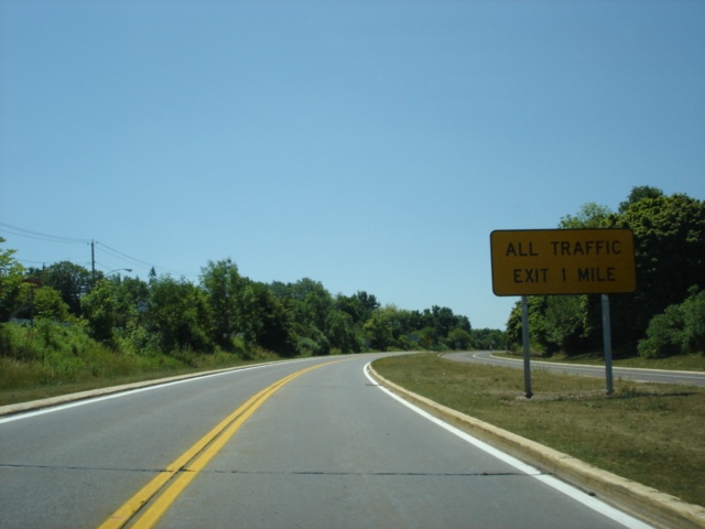 |
Robert Moses Parkway South does not go through downtown Niagara Falls. Motorists must use New York 384 to make the connection. All traffic must exit in one mile. (Photo taken 7/10/05) |
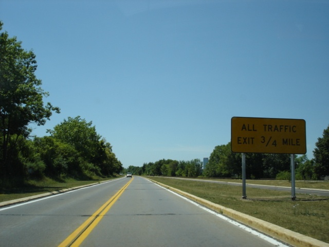 |
Robert Moses State Parkway South approaching the end of the Niagara Falls-to-Youngstown segment in 3/4 mile. (Photo taken 7/10/05) |
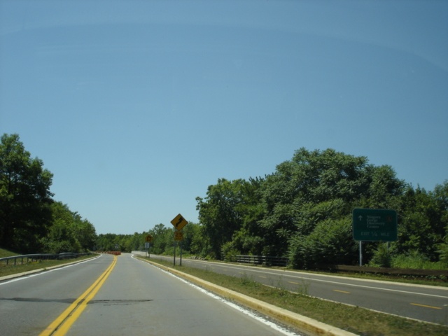 |
Robert Moses State Parkway South approaching an exit to the Niagara Gorge Discovery Center in one-quarter mile. (Photo taken 7/10/05) |
 |
Robert Moses State Parkway South as it leaves the mainline. (Photo taken 7/10/05) |
 |
These blue waterfall signs are located all over the Niagara Falls area, which point to the falls the city is known for. The turnoff to the Gorge Discovery Center is just past the pedestrian bridge ahead. (Photo taken 7/10/05) |
 |
Robert Moses State Parkway South approaching New York 104 and New York 384. The parkway transitions onto New York 384 and Rainbow Boulevard just around the bend. (Photo taken 7/10/05) |
 |
Continue on New York 384 South to the falls. Turn right onto New York 104 West to the Rainbow Bridge to Canada. (Photo taken 7/10/05) |
 |
Robert Moses State Parkway South at New York 104 and New York 384. The parkway is relegated to trailblazer status along New York 384, but its continuation is well signed. The stoplight here is Main Street. (Photo taken 7/10/05) |
| New York 384 South | |
 |
New York 384 South assurance shield and Robert Moses State Parkway trailblazer just past Main Street. The stoplight ahead is Niagara Street. (Photo taken 7/10/05) |
 |
New York 384 South at Niagara Street. Head east on Niagara Street to northbound Rainbow Boulevard for a return trip to the northbound Robert Moses State Parkway. (Photo taken 7/10/05) |
 |
Niagara Street westbound at New York 104, as seen from New York 384. The leftmost sign on this gantry is for New York 384 South. (Photo taken 7/10/05) |
 |
New York 384 South at the turnoff to the Niagara Falls State Park. The intersecting street is Mayor Michael C. O'Laughlin Drive. (Photo taken 7/10/05) |
 |
New York 384 South at the turnoff to southbound Robert Moses State Parkway. Trucks must continue on New York 384 to Interstate 190, while regular vehicles can take the more scenic parkway along the shore of the Niagara River. (Photo taken 7/10/05) |
| Robert Moses State Parkway South | |
 |
Robert Moses State Parkway South at the exit to the New York State Park and the American Falls. This marks the beginning of the other section of the parkway. (Photo taken 7/10/05) |
 |
Robert Moses State Parkway southbound as it passes underneath the ramps connecting the parkway to the state park. Again, no commercial trucks are allowed to use the parkway. (Photo taken 7/10/05) |
 |
A water fowl viewing area is located off of the parkway between downtown Niagara Falls and Interstate 190. (Photo taken 7/10/05) |
 |
Robert Moses State Parkway South at the water fowl viewing area. (Photo taken 7/10/05) |
 |
Robert Moses State Parkway South approaching the Power Authority water intakes and overlook parking in one-half mile. There are some interesting exits on the parkway between Interstate 190 and downtown Niagara Falls. (Photo taken 7/10/05) |
 |
Robert Moses State Parkway South at the Power Authority water intakes and overlook parking. (Photo taken 7/10/05) |
 |
Robert Moses State Parkway South approaching Interstate 190 - 1 mile. (Photo taken 7/10/05) |
 |
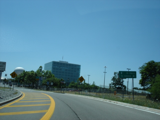
Robert Moses State Parkway South approaching Interstate 190 - 1/2 mile. The parkway concludes just after Interstate 190 with a ramp to the La Salle Expressway, a 2.5 mile freeway between Interstate 190 and Williams Road just north of New York 265 and New York 384. (Photo taken 7/10/05) |
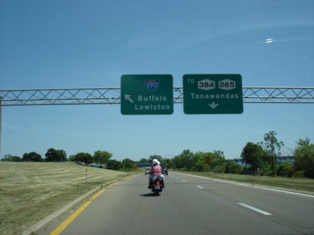 |
Robert Moses State Parkway South at Interstate 190 - Buffalo/Lewiston. Motorists must use New York 384 to make the connection to northbound Interstate 190. (Photo taken 7/10/05) |
 |
View of the off-ramp from the Robert Moses State Parkway to Interstate 190. Traffic going to Interstate 190 southbound immediately crosses the Niagara River on the North Grand Island bridge. Upon reaching the island, a 75-cent toll is charged. (Photo taken 7/10/05) |
Page created: January 30, 2006
Last updated:
January 30, 2006